Beautiful trekking beacuse of the destination, the view and the flora!
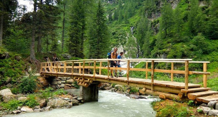
The path for the Tailli lakes (3,5 h) follows the tril to Otro Valley in the first part. After 30 minutes walk, arrived at a clear fork in the path near a beautiful stone fountain, take the path that leads to Alpe Gender. At the first Houses of Gender, the trail becomes steep and sometimes exposed and salt to the hut Alpe Tailli, beyond which it becomes more easy and takes about 40 minutes to the lakes.
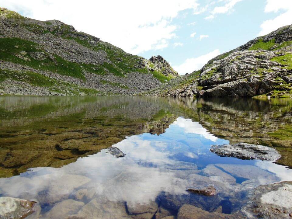
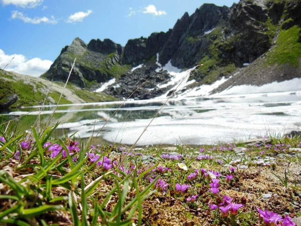
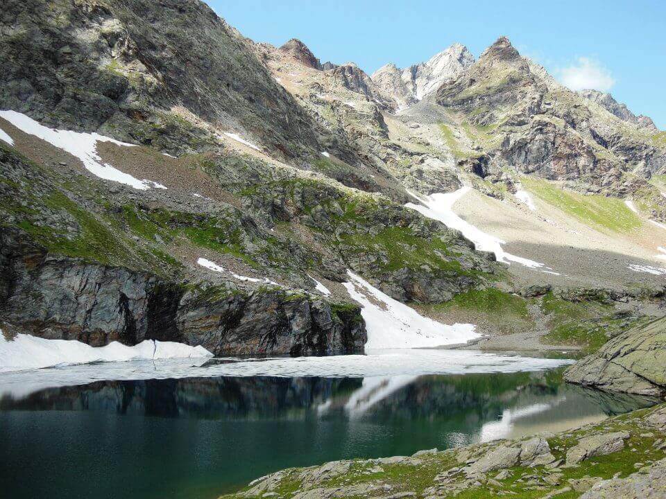
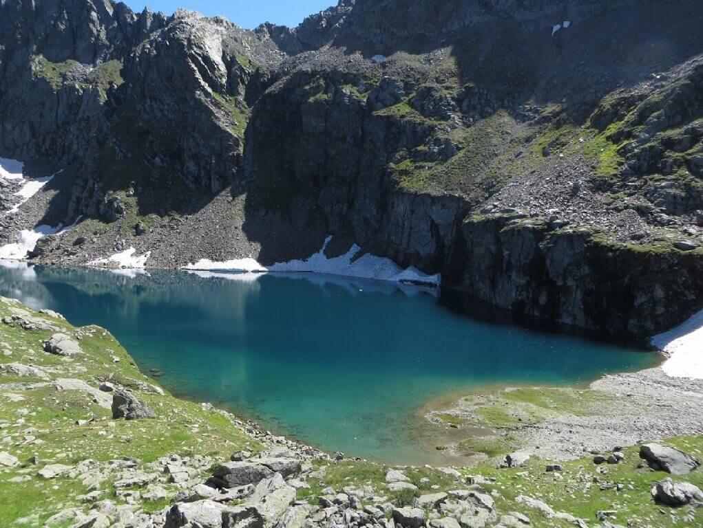
The large vast glacial lakes of Tailli at 2755 m is one of the most mystical places of the Val d'Otro. Well beyond the limit of vegetation, it is a succession of meadows and rocks, small ravines and soft valleys that surround two high altitude lakes often iced over which reflect the surrounding peaks. Buttercups, gentianellas, anemones and saltwort grow as far as the eye can see between the sparse grasses and mosses where it is not unusual to see ibex and chamois.
The climb to the Tailli lakes (3.5 hours) follows the initial part of trail no.3. Hiking for about half an hour, after a clear fork in the path near a clearing with benches enclosed by a wooden railing, you take trail no.3 towards Gender. At the height of the first house in Gender the trail becomes steeper and at times exposed and then climbs up to the refuge Alpe Tailli, beyond which it becomes easier and takes around 40 minutes to reach the lakes.